Vous êtes ici : Accueil |
|
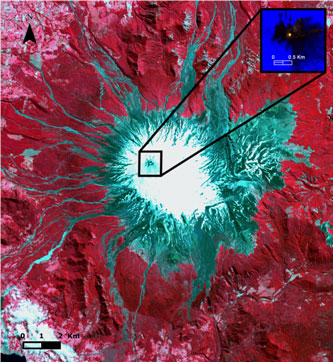
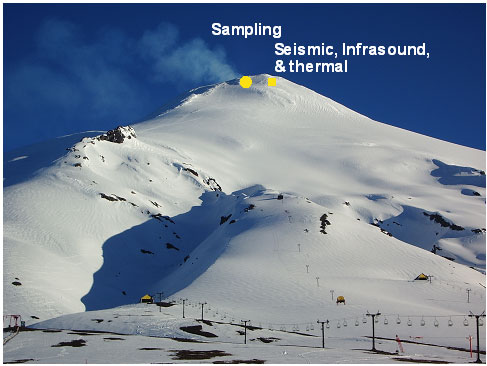
Villarrica, Chile Click on the yellow circle for the sample datas and click on the yellow square for the geophysical datas.
|

|

|
|
|
|
|||||||||||
|
|
|||||||||||
|
|||||||||||
|
|||||||||||
|
|||||||||||
| Mentions légales |