 |
| |
Recherche |
|
Mauna Ulu
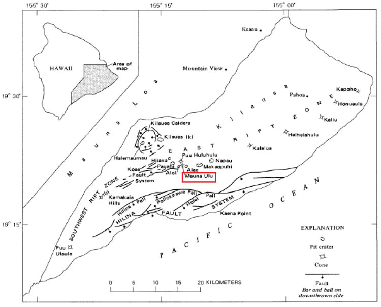
Map of Kilauea Volcano, showing the location of Mauna Ulu cone (Swanson et al. 1979)
Mauna Ulu |
Country |
Big Island, USA |
Location |
Kilauea, East Rift Zone, 9 km SE of the summit caldera |
Coordinates |
19°22'01" N 155°12'03" O |
Height |
121 m |
Age |
24 May 1969 |
Volcano Type |
Satellite shield |
Activity |
Effusive and lava fountaining |
Magma density |
2.91 gr/cm3(Robert et al. 2014) |
Muliwai a Pele lava flow details |
Activity |
effusive |
Dates of activity |
29/05/1974 |
02/06/1974 |
Duration of the channel |
50 h |
Extension of the channel |
8.6 km |
Mean output rate |
23 to 54 m³/s (Harris et al. 2009) |
Maximum effusion rate |
420 m³/s (Harris et al. 2009) |
Width and depth of the channel |
Data table |
Slope of the channel |
Data table |
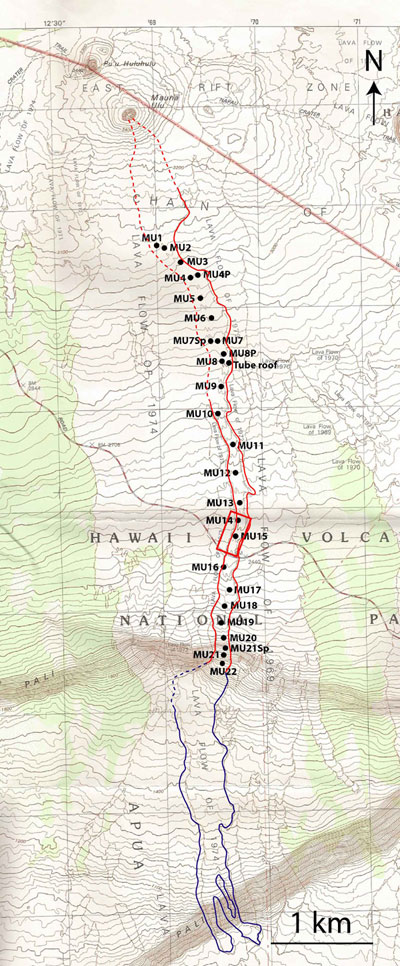
Map of the Mauna Ulu channel Ulu’s May-June 1974 channel-fed flow showing sample locations (USGS topographic map as base). The red rectangle is the location of the study of Harris et al. (2009)
Sample quantifications |
Description, morphology and size |
Data table |
Lava weight
Lava density
Lava porosity |
Data table |
Bulk chemistry |
Data table |
Glass chemistry |
Data table |
Minimum size of vesicle counted (pixel) |
10 |
Particle crystal content
Number of counted crystals x particle
Number of counted vesicles x particle
Particle 2D integrated vesicularity
Particle vesicle number density |
Data table |
Number of images (x magnification x area) |
28 Data tables |
Vesicle equivalent diameter
Vesicle area
Vesicle perimeter
Vesicle long axis
Vesicle short axis
Vesicle orientation
Image magnification |
28 Data tables |
Bins
Na
Nv |
28 Data tables |
|