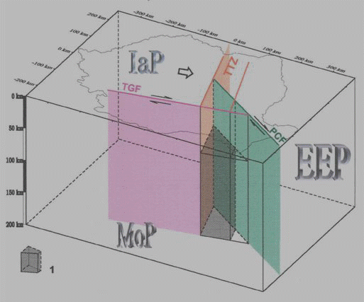
Basic sketch for Vrancea transform-transform compression unstable triple junction. EPP: East European plate; TTZ: Torquitz-Teysseire zone; PCF: Peceaneaga-Camena transform fault; TGF: Trans-Getica transform fault.
In order to increase the probability of recording EM signals related to earthquakes and volcanic eruptions, the number of pilot sites has been enlarged through international scientific cooperation.
The Franco-Romanian project is focused on the recognition of electric, magnetic and/or electromagnetic variations possibly correlated with seismic activity. The Vrancea zone is
submitted to large earthquakes of magnitude up to 6 occurring at several tens of kilometres depth.
The Vrancea natural laboratory is very unique for researches on Earthquakes mitigation.
Among the peculiarities mentions should be made to the followings:
- the small, strictly confined area of the epicentral zone, corresponding to an ellipse-shaped region having its large axis, of about 70 km length, striking northeastward, and the small one, of about 35 km length;
- the almost vertical distribution of hypocenters till depths that exceptionally exceed 180 km, with a practically aseismic zone located between 40 and 60 km;
- the high frequency of earthquake occurrence corresponding to the same epicentral area (small magnitude events practically daily occur);
- several times in a century disastrous earthquakes with magnitude significantly exceeding 7.0 on the Richter scale are triggered;
|
|
|
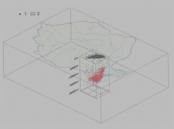
| Intermediate depth seismicity for Vrancea zone. Hypocenters according to Romplus catalogue (Oncescu et al., 1998). |
Basic sketch for Vrancea transform-transform compression unstable triple junction. EPP: East European plate; TTZ: Torquitz-Teysseire zone; PCF: Peceaneaga-Camena transform fault; TGF: Trans-Getica transform fault. |
The main involved Institute are :
Institute of Geodynamics of Romanian Academy (IGRA) ; http://www.academiaromana.ro/inst_geodin/pag_geodin_hist.htm
Group of Geodynamics of the Romanian Academy of Technical Sciences (CG-RATS) ; http://www.icsroscher.de/CARiMan/ASTR.htm
The objective of the Franco-Japansese project is to use the electromagnetic monitoring system in the northern Izu arc to identify the EM signals due to earthquakes and volcanic activities by near-field observations and to clarify the transmission of high-frequency EM disturbances at relatively far-field as well as by satellite observations.
The main involved Institutes are :
Tokai University ; http://www.riken.go.jp/engn/
Tokyo University ; http://www.eri.u-tokyo.ac.jp/
Kyoto University ; http://www.dpri.kyoto-u.ac.jp/default.html
Chiba University ; http://www.chiba-u.ac.jp/EN/index-e.html
Tokyo Metropolitan Government ; http://www.metro.tokyo.jp/english/
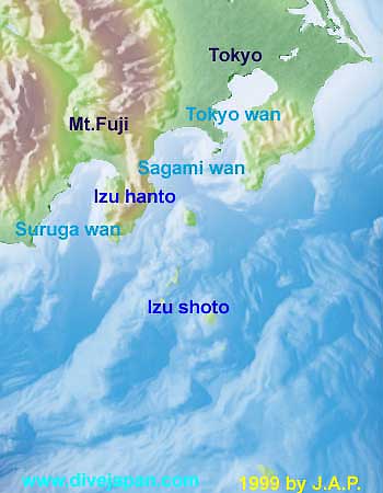 |
| The northern Izu Island arc is a tectonically active region, where several inter-/intraplate damaging earthquakes and severe earthquake swarms as well as eruptions have taken place. |
|
|
|
|
Document by Earthq. Res. Inst., Univ. Tokyo (ERI) |
Document by Geographical Survey Institute (GSI) |
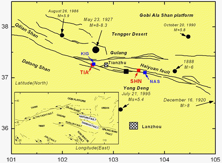
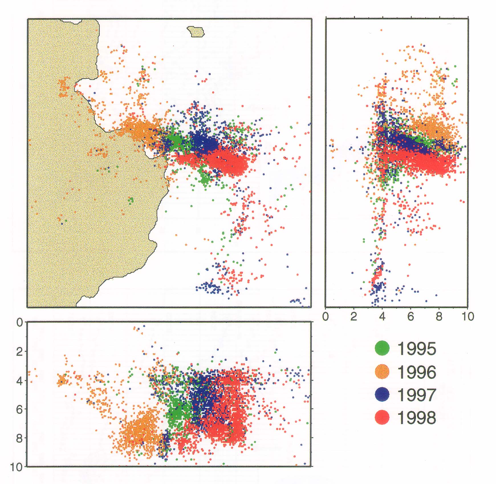
The Franco-Chinese cooperation is devoted to the preparation of large earthquakes up to magnitude 8 on the Tianzhu seismic gap along the Altyn Tag fault. The objective is to identify and locate abnormal transient ULF variations (periods from a few Hz to several tens of minutes.
The main involved Institutes of the Chinese Earthquake Administration are :
Lanzhou Institute ; http://www.icce.ac.cn/icce/cea/cea.htm
Beijing Institute ; http://www.icce.ac.cn/icce/cea/cea.htm
|
|
|
|
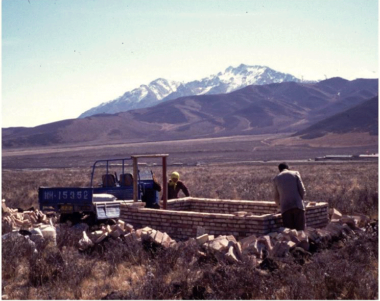
CNRS-CEA cooperation. Construction of TIA station on Tianzhu fault |
Location of TIA and SHN EM stations. KIG and NAS are seismic stations. |
.jpg)