|
|
|
|
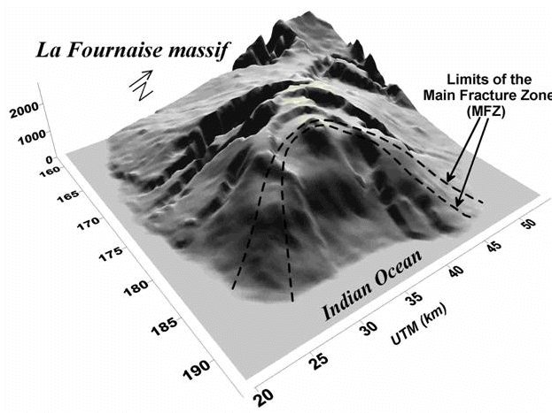
Topography of La Fournaise volcano. The two dashed lines represent the extension of the Major Fracture Zone (MFZ). |
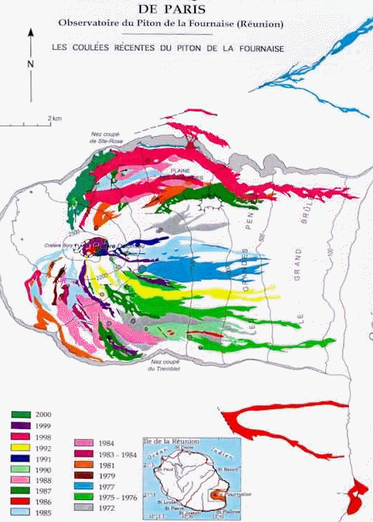
Lava flows between 1972 and 2000 (after IPGP). (http://volcano.ipgp.jussieu.fr:8080/reunion/coulees/coulee.html) |
La Fournaise volcano is a basaltic volcano, 2650 m high. The volcanic activity is expressed by fissure eruptions taking place along a mechanical weakness axis (MFZ).
Since 1998 the volcano has erupted two times every year.
Several monitoring networks are set on the volcano to follow the volcanic activity.
La Fournaise observatory (http://volcano.ipgp.jussieu.fr:8080/reunion/stationreu2.html) is locally in charge to forecast the eruptions under the responsibility of IPG-Paris (http://www.ipgp.jussieu.fr/index2.html).
|
|
|
|
Topography of La Fournaise volcano. The two dashed lines represent the extension of the Major Fracture Zone (MFZ). |
Lava flows between 1972 and 2000 (after IPGP). (http://volcano.ipgp.jussieu.fr:8080/reunion/coulees/coulee.html) |
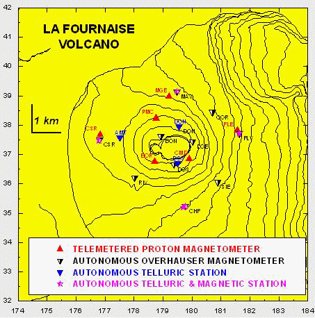
On La Fournaise volcano several types of combined magnetic, electric and electromagnetic networks have been developed in the past :
A real time telemeter magnetic network based on proton magnetometers (total field intensity, 1 minute sampling) maintained by La Fournaise volcanic observatory,
A research network of autonomous, self-recording stations of the components of the magnetic and electric fields (0.05 Hz to 0.5 Hz sampling),
A research network of autonomous stations recording the total magnetic field (0.05 Hz),
A continuous station equipped with induction horizontal coils associated with telluric lines in the frequency band (50 Hz – 0.01 Hz).
The monitoring EM station supported by the CNES is set in this integrated EM network where ULF electric and magnetic signals have been already reported.
It was shown that the fluids are mainly responsible of the observed signals (electrokineic mechanism).
|
|
Location of the magnetic, electric and EM networks on La Fournaise volcano. The EM Demeter ground-based ELF station is figured by an inverse blue triangle.
|
The objective of the ground-based Demeter station is to enlarge the frequency domain of the EM studies toward the high frequency domain, mainly the ELF one, and to evaluate is such signals can be detectable by satellite observations.
Located on the western flank on the summit cones the EM station records the horizontal magnetic and electric fields in the north and east directions.
Two orthogonal horizontal induction coils record the north and east components of the magnetic field (frequency band of the sensors 8 Hz-8 kHz).
Two horizontal buried electric lines of 50 m length record the electric field along the North-South and East-West directions.
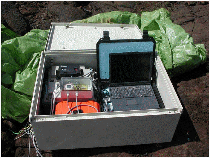
The data acquisition system is based on a laptop computer which records the EM field through a 12 bits analogue-digital 8 channels board. The time synchronisation is secured by a GPS receiver (Global Positioning system). Data are stored on a 60 Mo hard disk which is changed every six months during field works.
On thie PC computer data are measured every 3 hours during 5 minutes at 10 kHz
.The EM equipment is constrained to use 12 volts batteries recharged by solar panels.
|
|
|
|
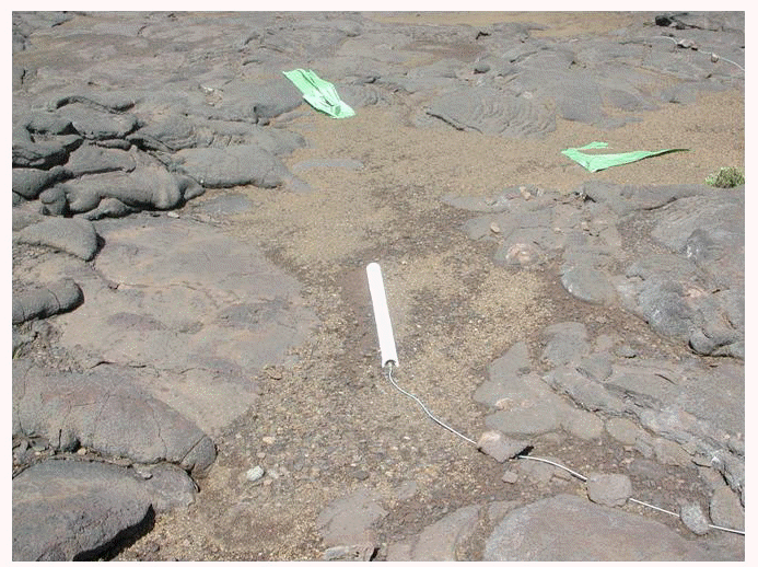
Magnetic induction coil for ELF records (frequency band 8-8000 Hz). Two horizontal sensors are set orthogonally between them in the North and East directions. The sensors are buried.
|
The EM Demeter ground based acquisition system on La Fournaise volcano.
|